I’ve made no secret of my love for maps, whether it be framed maps on my wall or map coasters…give me a map and I’m happy! I’ve already built up quite a little collection of Ordnance Survey maps, which I keep hidden away from the kids because the moment they get their hands on them they insist on opening them out fully and such are my tessellation skills I can never quite get the big ones folded back the right way if I’ve not opened them myself!
Much as I prefer to view a physical map, there are times when it’s just easier and quicker to view them on your computer. Once you’ve bought an OS map you are able to view it digitally for free, or you can sign up for a paid subscription to OS and access them all.
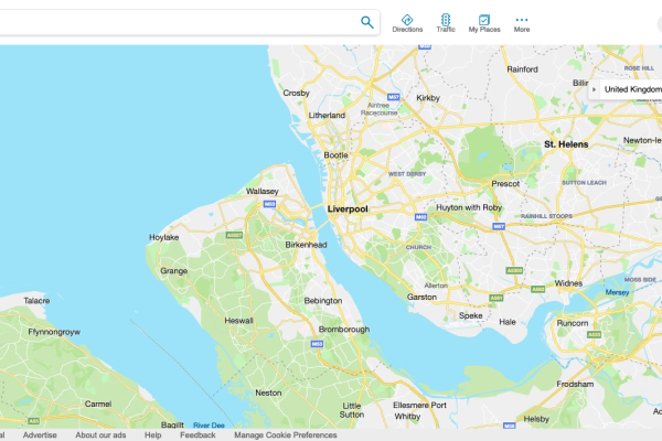
However there is a little known trick to access OS maps digitally for FREE simply by using the maps facility on the search engine Bing. As an avid walker, I use this all the time!
Just a quick note before I show you how to do it. This trick only works on laptops/desktops and Andriod mobiles, unfortunately I couldn’t get it to work on iPhones (do let me know if you find a way) but you could always take a screenshot of the map on your laptop, then access it from your phone’s photo gallery when you’re out on a walk.
On a laptop/desktop:
- Go to https://www.bing.com/maps
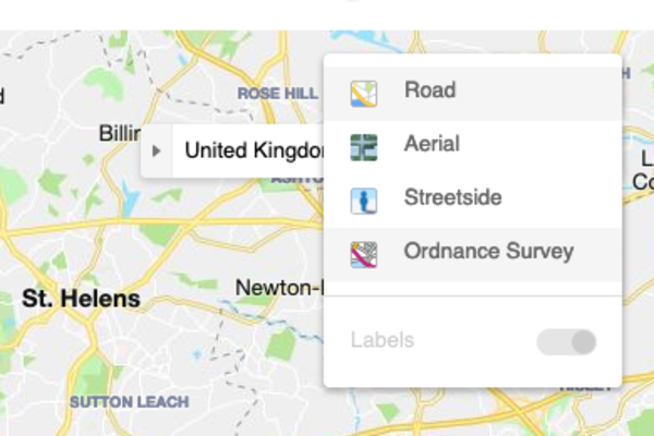
- In the top right hand corner, hover your mouse over the ‘Road’ button and click on ‘Ordnance Survey’
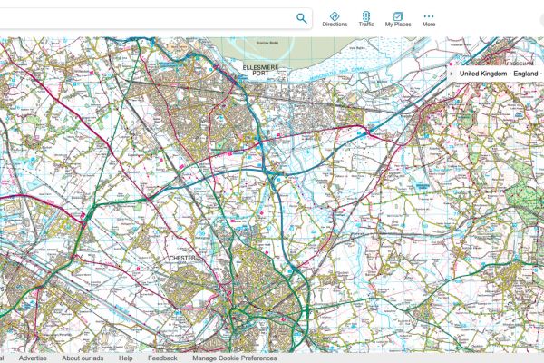
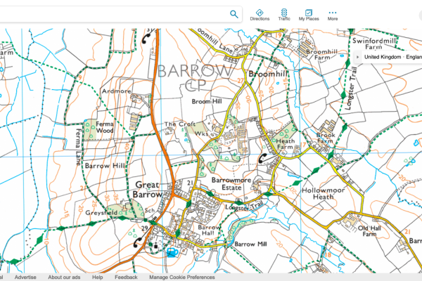
- At first the map won’t look any different, but one click on the ‘+’ zoom in, the map will change to the more recognisable OS format.
- However, keep zooming in (press ‘+’ another 3 times) and it will drill down to the OS map where you can view the public right of ways.
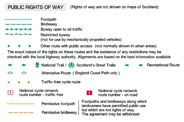
- In this example I’ve zoomed right in on the centre of the village of Great Barrow, Cheshire. To find the public right of ways you’re looking for the various types of green dots. I’ve put the OS map key below so you can see what all the different types are, but it doesn’t matter too much as it’s a green dotted line you have permitted access! In Great Barrow you can see a recreational route running right through the village, as well as other footpaths all around it.
On an Android Phone:
- Go to https://www.bing.com/maps
- Click on the 3 vertical dots on the top right hand of the screen.
- From the menu which appears, click on ‘Desktop site’.
- It’s fiddly to see, but near the top right hand of the screen you’ll see a circle, click on the circle and you’ll get the map options of Road/Satellite/Ordnance Survey/Birds eye Streetside.
- Click on the Ordnance Survey circle, then click away anywhere on the screen to remove the menu.
- To remove the Local Guide panel so you can see more of the screen, just click the ‘x’ on the top right of it
Before you leave please do take a look at the rest of my website which is full to the brim of fantastic walks in North Wales, Cheshire, Shropshire & The Wirral, as well as lots of family friendly attractions, cycles and parks to visit.
